At £369 per hectare, some East Anglian farmers are earning more from their cover crops than from the cash crop alongside them. Almost every income-generating action in that stack can be delivered by a contracted agricultural drone - no tractor, no compaction, no capital tied up in machinery.
That's a real figure, from a real OSR grower profiled by Farmers Weekly, achieved by stacking six SFI actions on the same ground. What the coverage of that farmer tends to skip over is the delivery question. The summer cover crop, companion crop, precision fertiliser pass, and integrated pest management commitment - all of it is drone-deliverable. And for the 10-15% of most farms that ground equipment cannot sensibly reach - waterlogged peat, riparian margins, scheduled earthworks, steep forestry planting ground - drones aren't simply an alternative route to those SFI and Countryside Stewardship Higher Tier payments. They're frequently the only route.
SFI26 opens its first application window in June 2026. If you're mapping your application now, here's the field-level guide the Defra action pages don't give you.
The 2026 SFI Landscape in 90 Seconds
SFI26 is Defra's consolidated successor to the current Sustainable Farming Incentive, with 71 actions - down from 102 in earlier iterations - and a £100,000 annual payment cap per farm business. Applications run in two windows: June 2026 for smaller farms and those without existing ELM agreements; September 2026 for all others.
The detail that matters most to delivery planning is Defra's shift to "doing and documenting."
Payments are now tied to evidenced action on specific land parcels - geo-tagged photographs, dated field operations records, seed-mix invoices, and application logs by parcel. Signed declarations and tractor field books are no longer sufficient on their own.
This is where drones for SFI payments have a structural advantage that has gone largely unremarked. Every commercial agricultural drone flight produces, automatically and as a matter of course, an RTK-corrected flight log, per-square-metre application records, time-stamped before/after imagery, and a certified operator's compliance pack. That isn't a workaround for Defra's evidence requirements. That is exactly what Defra's evidence requirements describe, generated without any additional effort on the farm's part.
Which SFI and CSHT Actions Can Drones Deliver?
The table below maps the principal actions across SFI26 and Countryside Stewardship Higher Tier where drone delivery is either demonstrably advantageous or, for a meaningful subset, the only practical option. All payment rates are current Defra-published figures.
| Action | Description | Payment | Drone Advantage |
|---|---|---|---|
| CSAM2 | Multi-species winter cover crop | £129/ha/yr | Undersowing into standing cash crops before harvest |
| SOH3 | Multi-species summer cover crop | £163/ha/yr | Fast establishment on wet or post-harvest ground |
| CIPM3 | Companion crop on arable land | £55/ha/yr | Precision undersowing without damaging the cash crop |
| SAM3 | Herbal leys | £224/ha/yr | Overseeding into existing swards without tillage |
| CNUM2 | Legumes on improved grassland | £102/ha/yr | Broadcast into established grass at 5-10mm spec |
| PRF1 | Precision fertiliser application | £27/ha/yr | Variable-rate is the native drone operating mode |
| CIPM4 | Integrated pest management | £45/ha/yr | Targeted spot application in place of blanket treatments |
| CHS9 | Restricted cultivation - archaeological features | £257/ha/yr | Zero cultivation depth; no disturbance risk to buried features |
| CSW17/18/19 | Cropped peat with raised water table | Defra rate | Ground machinery cannot access; drone is functionally essential |
| CSW8/CSW24 | Riparian buffer establishment | Defra rate | No compaction adjacent to watercourse |
| CWD1/CWD2 | Woodland creation and improvement | Defra rate | Remote and steep land inaccessible at scale by hand |
Cover Crops, Herbal Leys and Companion Crops
These are the foundation of most high-value SFI stacks. Understanding the drone advantage here isn't just about whether a drone can do the job - it's about whether it can do it in the window that makes the payment worth claiming.

CSAM2, SOH3 and CIPM3: The Cover Crop Stack
CSAM2 (multi-species winter cover crop, £129/ha/yr) and SOH3 (multi-species summer cover crop, £163/ha/yr) are the workhorses of most combinable-area SFI applications. Add CIPM3 companion crops at £55/ha/yr and you already have £347/ha before a water management or soil improvement action appears on the sheet.
The specific drone advantage for CSAM2 and CIPM3 is undersowing - seeding cover or companion species into a standing cash crop two to three weeks before harvest. The standing stems and canopy shelter germinating seed from rainfall impact; by the time combining finishes, establishment is already underway rather than starting from a bare seedbed. A tractor cannot do this without flattening the crop it's trying to undersow into. A DJI Agras T40, T100, or XAG P100 Pro can be above the crop canopy in minutes.
Speed matters as much as access. A drone in spreading mode covers roughly 1 ha in 5-7 minutes - that's ten to fifteen times the throughput of a ground rig on waterlogged or post-harvest stubble. In July 2025, a Lincolnshire grower using a contracted operator had 17 ha of stubble turnips seeded within four days of first contact. Cover-crop sowing windows are narrow; the establishment method that can respond in days rather than weeks is worth more than the rate comparison suggests.
There's a fuel figure that tends to get left out of these discussions. Conventional cover crop establishment runs at around 17 litres of diesel per hectare - approximately £23-25/ha in fuel alone, before labour and depreciation. The drone pass has none of that overhead. The SFI income that was offsetting machinery costs is, instead, margin.
SAM3 and CNUM2: Overseeding Without Ploughing Out
SAM3 (herbal leys, £224/ha/yr under SFI26) and CNUM2 (legumes on improved grassland, £102/ha/yr) both require establishment into existing grass swards. The conventional approach involves power harrowing, overseeding, and hoping the existing sward hasn't been set back enough to allow weed ingress - which frequently means ploughing out productive pasture before you can achieve a clean establishment.
Defra's own guidance for SAM3 explicitly permits broadcast seeding or shallow drilling at 5-10mm. Drone broadcast seeding sits squarely within that specification and avoids any disruption to the sward structure. For grazed leys or hay meadows within a cutting rotation, land can remain productive throughout; the sward is diversified without the compaction penalty of a harrowing pass on a field that won't benefit from it.
Four Action Families Where Drones Are the Only Practical Option

Beyond the mainstream cover-crop and ley payments, there is a category of SFI and CSHT actions where conventional ground delivery is either physically impractical, ecologically counterproductive, or both. For these parcels, a contracted drone is the difference between claiming the payment and leaving it.
CHS9: Archaeological Features and Restricted Cultivation (£257/ha/yr)
This is the action that consistently surprises agronomists when they read the wording in full. CHS9 - a five-year CSHT action paying £257/ha/yr - requires: "use shallower cultivation depths and direct drilling where subtle earthworks survive, combined with cover crops to improve the resilience of soil structure."
A drone broadcasts seed onto completely undisturbed ground. Zero cultivation depth, zero compaction, and no risk of damaging the buried feature that makes the land eligible in the first place. No other establishment method satisfies CHS9's requirements with zero compromise.
Any farm with parcels catalogued on its Historic Environment Farm Environment Record (HEFER) - viewable via the MAGIC mapping tool - may qualify. HEFER coverage across the English arable estate is substantial, particularly on the Yorkshire Wolds, across Cotswolds plateau fields, and on chalk downland in the South East. Many farms carry HEFER-mapped hectares they've never successfully monetised, because the cultivation constraints that make them eligible also make conventional establishment impractical.
CSW17, CSW18 and CSW19: Peat Soils With Raised Water Tables
These three actions concern cropped peat managed with deliberately raised water tables - typically to within 10-30 cm of the surface year-round. The logic is straightforward: when you achieve the conditions these actions require, you have simultaneously created the conditions in which conventional machinery sinks. The Fens, Somerset Levels, and Lancashire mosslands have hundreds of thousands of hectares where this is not a theoretical constraint.
A drone is, in practice, the only mechanised establishment route on land managed correctly under CSW17-19. That's not a competitive advantage claim - it's a physical description of what happens when a water table is where Defra wants it to be.
CSW8 and CSW24: Riparian Buffer Establishment
Buffer-zone establishment on land immediately adjacent to watercourses is, in an obvious way, somewhat self-defeating if the establishment method involves heavy machinery compacting and rutting the soil it's meant to be protecting. Ground equipment operating within a few metres of a watercourse is itself a significant source of the sediment and runoff that these actions were created to reduce.
Drone delivery seeds the buffer from above without wheel contact, without soil disturbance, and without the risk of a tractor on a waterlogged bank becoming a different kind of field incident altogether.
CWD1 and CWD2: Woodland Creation and Improvement
UK forestry is already generating some of the most compelling evidence available for drone-seeding at scale. In December 2025, Scottish Water and AutoSpray Systems completed the first BVLOS (Beyond Visual Line of Sight) heavy-lift drone-seeding operation in UK forestry - 2.1 million native pelleted tree seeds across 20 ha at Talla Reservoir in the Scottish Borders. Forestry and Land Scotland ran a parallel trial on the A83 in Argyll with Forest Research. The Dubh Allt rewilding project in Moidart followed shortly after.
These are commercial operations on real land with real targets, not experimental proofs of concept. CWD1 and CWD2 payments apply to precisely the kind of steep, remote, ecologically sensitive ground where hand-planting at programme scale is either undeliverable or prohibitively expensive.
The Stack Maths: Three Worked Examples
Payment rates are only compelling when they're grounded in actual farm scenarios. Here are three.
Example 1 - The Farmers Weekly OSR Grower (£369/ha)
A real East Anglian farmer stacking SOH1 (£73/ha) + PRF1 (£27/ha) + CIPM3 (£55/ha) + CIPM4 (£45/ha) + SOH3 (£163/ha) + CSAM1 (£6/ha) = £369/ha across the combinable area. Of those six actions, all but SOH1 itself can be drone-delivered.
Example 2 - Claydon Farm (£349/ha average, £88,995/yr)
Claydon Drill's 255-ha case study shows £88,995 per year from SFI stacking at a £349/ha blended average. The Claydon stack was built around their own direct-drill setup. Commission the same delivery via a contracted drone operator and the annual SFI income is identical. The capital expenditure is not.
Example 3 - A 200-ha Mixed Arable Farm in East Anglia
Allocate 120 ha to SOH3 and CSAM2 in rotation (blended average: £146/ha) = £17,520. Add 80 ha to SAM3 herbal ley overseeding at £224/ha = £17,920. Plus 150 ha of combinable area to PRF1 at £27/ha = £4,050. Plus 100 ha to CIPM3 and CIPM4 combined at a blended £100/ha = £10,000. Plus 15 ha of HEFER-mapped arable to CHS9 at £257/ha = £3,855.
Total annual SFI income: £53,345. Capital outlay for drone-delivered establishment: £0. Equivalent capital outlay for owned direct drill, variable-rate spreader, and applicator rig: £80,000-£150,000 depending on specification.
Same SFI cheque. Very different business case.

The Evidence Pack SFI26 Now Requires
SFI26's move to "doing and documenting" is creating quiet anxiety on farms where the field operations record is a notebook and the photographic evidence is whatever was taken on a phone at the time. Both are technically compliant - but both are also exactly what an inspector knows can be assembled after the event rather than during it.
Commercial drone operations generate evidence that cannot be retrospectively constructed. An RTK-corrected flight log is timestamped against satellite positioning data and the operator's flight management system. The per-parcel application rate map shows precisely how much material went where. Multispectral before/after imagery carries embedded EXIF metadata. The CAA Operational Authorisation and HSE aerial application certificate that the operator holds come with every job pack as standard.
What the evidence pack contains
When Drone Spraying UK completes a drone-seeded cover crop, herbal ley, or tree-seeding assignment, the farm receives: RTK flight log by parcel, application rate map per square metre, dated before/after imagery, seed mix documentation, and operator compliance certificates - packaged for direct submission against the relevant SFI action. It arrives with the invoice.
That's not something designed to be sold as a feature; it's simply what a professional drone operation produces as a matter of course.

For any farm anticipating inspection under SFI26, the question is worth asking plainly: which of your current delivery methods would hold up to scrutiny with the same confidence?
Do You Need a Drone Licence?
There's a distinction worth being clear about here, because it comes up early in most conversations with farmers considering drone-delivered SFI work.
Operating an agricultural drone at the scale required for SFI field work - machines like the DJI Agras T50, T70, T100 - requires Advanced Category CAA Operational Authorisation under the UK Air Navigation Order. Aerial application of any pesticide, herbicide, or adjuvant additionally requires a separate HSE aerial application certificate, managed by the Health and Safety Executive. Commercial pilot training must be to Lantra-accredited standards. BVLOS operations, where required for remote or large-scale forestry work, are licensed case-by-case by the Civil Aviation Authority. Getting all of that in order typically takes months and, realistically, runs into five figures before a single hectare is treated.
Operators like Drone Spraying UK already hold the required CAA Operational Authorisation and HSE aerial application certification, along with £10 million-plus public liability cover.
The farmer's job is to identify which actions they're claiming, confirm the land qualifies, and commission the field work. Regulatory compliance is the operator's responsibility, not the landowner's.
One practical note on timing: Drone Spraying UK can typically mobilise to a UK farm within days of a site assessment. For the narrow sowing windows that SOH3, CSAM2, and SAM3 all operate within, that lead time matters considerably.
What Working With Drone Spraying UK Actually Looks Like

The case studies cited in this piece - Talla Reservoir, Dubh Allt, the Lincolnshire 17-ha cover-crop turnaround, Eves Hill Farm in Norfolk - describe what drone-delivered SFI and environmental scheme work looks like at scale. What they don't describe is the practical picture for an individual UK farm.
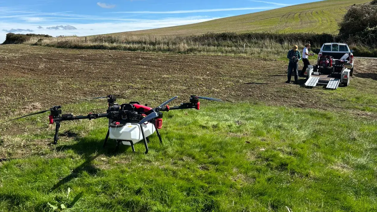
Coverage and throughput. In spreading mode, expect roughly 1 ha in 5-7 minutes. In spray mode, approximately 19 ha/h at standard agricultural rates. For granular material - whether cover crop seed, herbal ley mixes, or pelleted tree seed - the DJI T50 handles up to 1,300 kg/h throughput. Seventy hectares of cover crop that would take two days with a ground rig can realistically be completed in a single long day, weather-permitting.
The unfarmable acres payoff. Most farms carry 5-15% of their land that ground machinery cannot profitably work - too steep, too waterlogged, too archaeologically constrained, or simply too small and awkward for a tractor turning circle to justify. SFI and CSHT actions frequently pay more on precisely this category of land, because the environmental conditions that make it hard to farm conventionally are the same conditions Defra is paying to maintain. A drone re-opens the economic question for land that has been generating nothing.
Conditions tractors avoid. The Drone Spraying UK team operates across UK regions in conditions that rule out conventional ground equipment: standing water, recently drilled fields where compaction damage would undermine the SFI case, post-harvest stubble in wet autumns, riparian margins, and upland planting sites. The operational envelope that makes drone delivery relevant for SFI work is precisely the envelope that ground machinery leaves behind.
The two questions farmers ask first. Insurance and liability: Drone Spraying UK carries £10 million-plus public liability cover, and the operator's CAA Operational Authorisation specifies the operational conditions under which each flight is permitted. Whether your land qualifies: a site assessment call covers terrain flyability, parcel eligibility, and which actions stack best on your specific acreage - before any commitment is made.
Preparing Your SFI26 Application
SFI26 Window 1 opens in June 2026 for smaller farms and those without existing ELM agreements. Window 2 follows in September 2026 for all applicants. The £100,000 annual cap applies per Single Business Identifier (SBI) across all actions in an agreement - total stacked payments cannot exceed this figure regardless of how many actions are combined.
The practical preparation sequence:
- Confirm your Rural Payments Agency registration and SBI number - without one, there is no application.
- Audit your land against the HEFER and MAGIC mapping tools to identify CHS9-eligible parcels, peat-soil classifications (CSW17-19), riparian margins (CSW8/24), and any woodland creation candidates (CWD1/2).
- Map your combinable area against the cover-crop and ley actions that form the core of most high-value stacks.
- Get a site assessment from Drone Spraying UK to confirm which parcels are flyable, which actions stack best on your acreage, and what the delivered cost per hectare looks like before a single line goes into the application.
SFI agreements run for multiple years. An application built around delivery methods you can't confidently execute isn't an income stream - it's an inspection risk.
Frequently Asked Questions
Can drone seeding satisfy SFI26 evidence requirements?
Yes. RTK-corrected flight logs, per-parcel application rate maps, and time-stamped imagery are precisely the geo-tagged, dated field operation records that Defra's "doing and documenting" standard requires. In many respects, drone-generated evidence is more audit-robust than conventional tractor field records because it is produced automatically and cannot be retrospectively assembled.
Which SFI and CSHT actions can be delivered by drone?
The principal ones are CSAM2, SOH3, and CIPM3 (cover crops and companion crops), SAM3 and CNUM2 (herbal leys and legumes), PRF1 (precision fertiliser), and CIPM4 (integrated pest management). CHS9 (restricted cultivation on archaeological features, £257/ha/yr) is a strong candidate where HEFER-mapped land is present. Water management actions CSW17, CSW18, CSW19, CSW8, and CSW24 are effectively drone-exclusive on qualifying parcels. Woodland creation actions CWD1 and CWD2 are deliverable at scale on remote or steep ground.
Do I need a CAA licence to commission drone work?
No. The licensing and regulatory obligations rest entirely with the operator. Drone Spraying UK holds the CAA Operational Authorisation and HSE aerial application certificate - you commission the field job, they handle the compliance.
Is aerial application of fertiliser legal in the UK?
Granular and liquid fertiliser spreading by agricultural drone is permitted in the UK. Aerial application of pesticides and plant protection products is separately regulated by the HSE and requires the aerial application certificate that commercial operators hold. Any operator you engage should be able to demonstrate both their CAA authorisation and HSE certification before work begins.
Can I claim SFI on land that's currently too wet or steep for machinery?
Often yes - and this is one of the most consistently underused aspects of the scheme. Peat soils, riparian margins, and steeply sloping land frequently qualify for the highest-value CSHT actions because the environmental characteristics that make them difficult to farm conventionally are exactly what Defra is trying to preserve or restore. A drone re-opens the eligibility question for parcels that have been written off as commercially unworkable.
What is the £100,000 cap and how does it interact with stacking?
The £100,000 is an annual payment ceiling per farm business - specifically per Single Business Identifier (SBI) - across all actions within an SFI26 agreement. Stacking multiple actions on the same hectare is both permitted and encouraged by Defra; the cap simply means that total annual payments across your entire agreement cannot exceed £100,000. Most farms with a thoughtfully structured application will reach the cap before running out of eligible actions.
When do SFI26 windows open?
Window 1 opens June 2026, prioritised for smaller farms and those without current ELM agreements. Window 2 opens September 2026 for all applicants. Countryside Stewardship Higher Tier applications run on a separate cycle through Natural England and should be confirmed directly with your local Natural England advisor.
If the June Window Is on Your Radar, Now Is the Right Time to Move
The farmers who will cash the largest SFI26 cheques in the coming agreement period are the ones who have already identified their eligible parcels, mapped which actions stack best on their acreage, and confirmed their delivery method before committing to an application. The stacking maths is straightforward once you know which actions your land actually supports.
Leaving HEFER-mapped arable, peat parcels, and riparian margins out of an SFI application because conventional machinery can't work them isn't a conservative approach to farming - it's leaving Defra money on the table, year after year, for the duration of an agreement.
If you're building your SFI26 application, or already hold a CSHT agreement and want to simplify delivery on difficult ground, speak to the team at Drone Spraying UK for a site assessment. They'll confirm which of your fields qualify, which actions stack best on your acreage, and what the delivered cost per hectare looks like before you commit a single line in the application. See our full range of services.